Toggle navigation
Home
(current)
Articles
(current)
Trip Reports
(current)
Search
Guest User
Sign-in
Register
Search Results
Filter
Activity Type
Ski Touring (50)
Orientation
East (50)
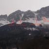
Col du Tépey east face from Valmaure; Belledonne; French Alps
RouteFrom the hamlet of Valmaure follow the GR to the hamlet of Le Tépey, continue along the torrent to the Pierre de Barme at 1765m.
2007-02-03 09:06:08
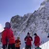
Pas de l'Oeille, Couloir des Sultanes
Nice couloir, never too steep. The area has generally good snowfall. Views of the Oisans, Mont Blanc and Vercors mountains.
2006-03-18 11:06:24
Col du Gleysin, by the combe des Roches; Belledonne; French Alps
RouteFrom the Roches hamelt take the trail towards the combe des Roches. Climb the valley to the Orselle (1672 meters, sign). Continue WNW then West to climb to the obvious col(s).
2004-03-07 08:07:05
Col des Balmettes via Fremezan; Belledonne, French Alps
RouteFrom St Collomban des Villards climb the Fremezan road. This is possible with a car if the road is cleared of snow..
2004-03-06 07:59:26
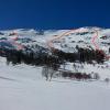
Puy du Rocher, Chamalière bowl, Massif Central, France
AccessCar park at 1273 meters before the Col de Prat de Bouc. From Clermont-Ferrand take the highway to the Massiac exit. Then the N122 towards Aurillac until you reach Murat.
2004-03-01 11:30:25
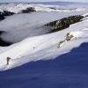
Puy du Rocher from le Lioran
I thought about doing the Puy Mary or Puy d'Arse but there was not enough snow. A little trip to get the ski touring legs working again. Very pretty scenery with the little Cantal mountains.
2003-12-07 10:49:39
Le Cerbillona; Bigorre; Hautes-Pyrénées; France
RouteFrom the cabane de Milhas (1680 m) take the track to the Ossoue dam following the GR 10. Stay on the left bank of the lake on a nearly flat path. Follow the Oulettes stream to some waterfalls.
2003-05-03 07:05:29
Grand Colon by the North-East bowl, Belledonne, French Alps
RouteFrom the parking at Pre Reymond (or from the "4 chemins" depending on the state of the snow), take a wide forest track to the south-east which you leave after half an hour of walking for a narrow
2001-02-21 08:39:33
Pointe de la Grande Chible from Valloire
From the village of the Poingt Ravier (1646m), head west to the Fouche huts(2100m). Pass just to the north of the the Crey du Meigno to reach the pas de Pertuité (2527m).
2000-01-01 15:52:20
Mont du Chat, Couloir des Chênaies, Chartreuse, French Alps
If possible park at the hairpin bend at (altitude 610m, viewpoint and picnic table) where the botanical trail begins. This is after the usual point of road closure for winter at le Poteau.
1970-01-01 14:41:55
Previous
1
2
3
4
5
6
Next